The Must Have GPS Tool For Surveying Professionals In 2022
Surveying equipment can run the gamut in functionality, size and usefulness. Some surveying tools are more likely to be used in one industry than another, while other pieces of surveying equipment are must-haves in almost every arena.
As a result, if you’re interested in knowing the answer to the question, “What equipment is used in surveying?,” the answer can range depending on who you’re asking.
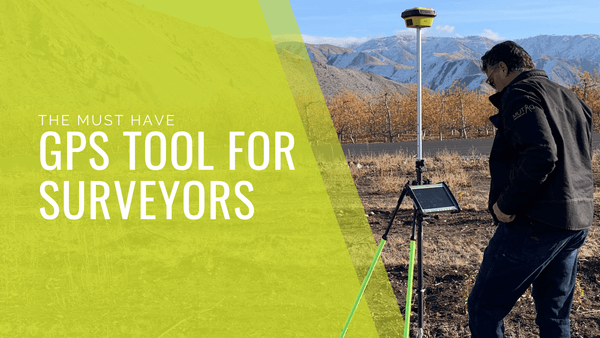
While every industry is unique, some surveying equipment is more ubiquitous than others. This is especially true of GPS equipment. Keep reading to learn why the Leica iCON GPS 70 T is the must-have GPS tool for surveying professionals in 2022.
Leica iCON GPS 70 T Features
The Leica iCON GPS 70 T is an excellent solution for gathering positioning data regardless of the construction site. Manufactured by Leica Geosystems, you know that you’re getting quality and reliability when you’re purchasing a Leica device, and the iCON GPS 70 T is no exception.
As a handheld tool, it takes up little space, but still manages to pack in an excellent array of features, functionality, and smart, forward-thinking design. Some of the most impressive specification and features of the leica iCON GPS 70 T include:
- Permanent tilt compensation
- Resistant to magnetic interference
- Calibration-free
- 555 channels for more signals, faster acquisition, and improved sensitivity
- Compact and lightweight housing
- Unique RTK technology provides continuous checks to guarantee correct results
- Built for extreme temperatures of -40°C to +65°C
- Easy-to-use software interface
- Integration with iCON field solutions
Schedule A Training Session Today!
iCON GPS 70 T Benefits
Some of the biggest benefits of using the iCON GPS 70 T for measuring stakeout points are its speed and efficiency. In traditional surveying, keeping the pole level and vertical are a must; however, the iCON GPS 70 T eliminates the need for leveling thanks to permanent tilt compensation features and a resistance to magnetic interference.
All of these features combine to create a piece of GPS surveying equipment that is ready to go in moments, no matter how rugged the terrain may be.
Beyond increasing the speed with which you can take field measurements, the Leica iCON GPS 70 T also increases accuracy by reducing the possibility for human error.
With greater accuracy and efficiency, this also means that you can take measurements in locations where a traditional approach would be less-than-ideal, or even dangerous. Being able to pay attention to your surroundings while surveying ultimately increases safety on your construction sites, which is a win-win.
What Industries Benefit From Utilizing The Leica iCON GPS 70 T?
Building construction and heavy construction are two of the major industries that can really get the most out of what the Leica iCON GPS 70 T has to offer.
At the same time, it’s hard to argue that any construction site wouldn’t appreciate the speed and productivity offered by the Leica iCON GPS 70 T, especially when you consider how it integrates with other tools and software pioneered by Leica.
Put simply: if an industry requires accurate surveying to run well, then the Leica iCON GPS 70 T has a place on its construction sites.If you’re wondering where to buy surveying equipment (or are interested in renting some surveying tools to see what works best for you and your needs), Datum Tech Solutions is an excellent option.
Datum Tech Solutions has built a strong reputation as a provider of construction and surveying equipment, tools and training. Our training videos are a great way to learn the ropes on a new piece of gear like the Leica iCON GPS 70 T, so that you know exactly how to get the most out of your surveying tools.
Whether you’re just brushing up on surveying or want to test-drive the latest surveying equipment, Datum Tech Solutions is in your corner.
Rent the Leica iCON GPS 70 T today!
View Leica iCON GPS 70 Purchasing Options
Looking for total station maintenance? Learn more about our Boise Calibration Center.